
Ida could hit New Orleans as a devastating Cat 3 hurricane
Published:Friday | August 27, 2021 | 9:11 AM
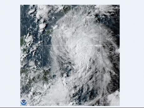
BATON ROUGE, La. (AP) — Tropical Storm Ida intensified as it swirled toward a strike on Cuba on Friday, showing hallmarks of a rare, rapidly intensifying storm that could speed across warm Gulf waters and slam into Louisiana as a Category 3 hurricane on Sunday, the National Hurricane Center warned.
“The forecast track has it headed straight towards New Orleans. Not good,” said NOAA's Jim Kossin, a climate and hurricane scientist.
Ida posed a relatively low threat to tobacco-rich western Cuba, where forecasters predicted a glancing blow on Friday.
The real danger begins over the Gulf, where forecasts were aligned in predicting Ida will strengthen very quickly into a major hurricane, reaching 115 miles per hour before landfall in the Mississippi River delta late Sunday or early Monday, experts said.
“Ida certainly has the potential to be very bad,” said Brian McNoldy, a hurricane researcher at the University of Miami.
“It will be moving quickly, so the trek across the Gulf from Cuba to Louisiana will only take 1.5 days.”
Friday morning, Ida's maximum sustained winds swiftly rose from 45 miles per hour to 60 miles per hour as it moved away from Grand Cayman toward Cuba's Isle of Youth at about 15 miles per hour.
Tropical storm force winds extended as far as 80 miles from the centre.
A hurricane watch for New Orleans and an emergency declaration for the state of Louisiana were declared. Category 3 hurricanes are capable of causing devastating damage.
“Unfortunately, all of Louisiana's coastline is currently in the forecast cone for Tropical Storm Ida, which is strengthening and could come ashore in Louisiana as a major hurricane as Gulf conditions are conducive for rapid intensification,” said Governor John Bel Edwards.
“By Saturday evening, everyone should be in the location where they intend to ride out the storm,” the governor added.
A hurricane watch was in effect from Cameron, Louisiana, to the Mississippi-Alabama border — including Lake Pontchartrain, Lake Maurepas and metropolitan New Orleans.
Dangerous storm surge was also possible along the Gulf Coast.
If it pushes a storm surge at high tide, Ida could overlap some levees, with 7 to 11 feet of water predicted from Morgan City, Louisiana, to Ocean Springs, Mississippi.
“There is an increasing risk of life-threatening storm surge, damaging hurricane-force winds, and heavy rainfall Sunday and Monday, especially along the coast of Louisiana,” the hurricane centre said.
Follow The Gleaner on Twitter and Instagram @JamaicaGleaner and on Facebook @GleanerJamaica. Send us a message on WhatsApp at 1-876-499-0169 or email us at onlinefeedback@gleanerjm.com or editors@gleanerjm.com.